Australia's Repair Storm Arrived. New Zealand Gets the Cleaner Bet.
Fresh snow finally hit the Australian Alps, but wind and base repair still define the week. Across the Tasman, Queenstown and Wanaka get the next front with a better operating floor.
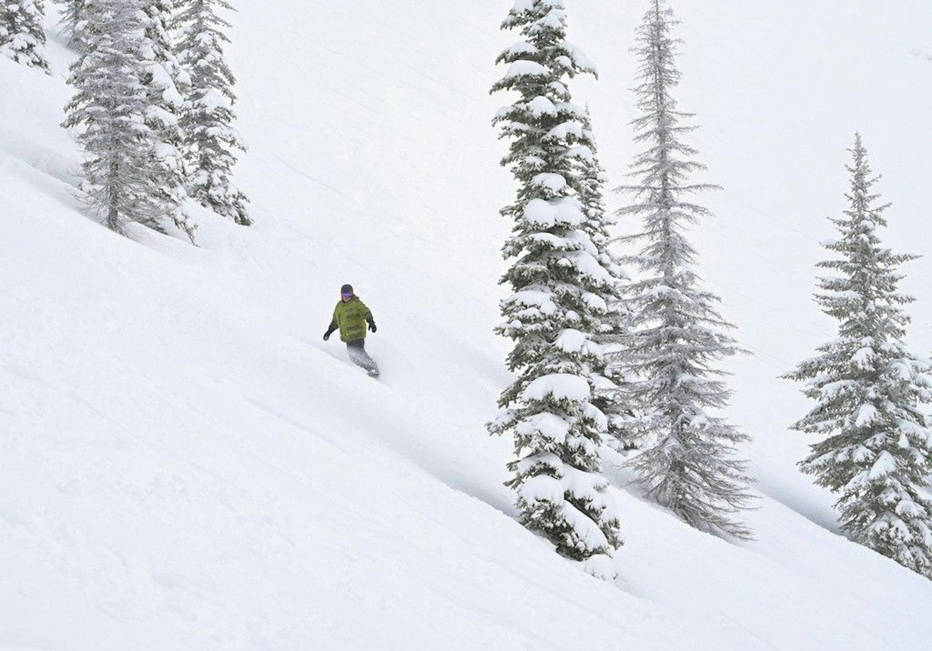
Australia got its repair storm.
Good.
Now comes the annoying part: figuring out how much of it actually turns into a better ski week.
The Australian Alps finally had a proper cold front roll through Tuesday night into Wednesday, and Mountainwatch's July 29 Australian forecast called the sequence clearly: 5-15cm by dawn in many resorts, another 3-8cm through Wednesday, strong cold westerly winds, then a cleaner Thursday-Friday stretch with snowmaking windows. Snowatch's July 29 update backed up the operational fine print: all resorts had fresh snow, Thredbo's top recorded 120km/h gusts at 2 a.m., and lift status was going to matter.
That is the whole story.
The storm arrived. The season did not magically reset.
Perisher is the Australian anchor again. Perisher's own report had 30 expected lifts, 34 groomed runs, fresh snow on top, and a warning that strong winds would affect operations. Snow-Forecast's Perisher snapshot had 30 of 47 lifts open, 34 of 65km of pistes open, and packed powder plus groomed snow after a model-estimated 3cm fell from Tuesday night into Wednesday morning.
Thredbo got the sharper version of the same deal. Thredbo's July 29 weather report expected major lifts including Karels, Basin, Snowgums, Antons, Merritts Gondola, Kosciuszko, Gunbarrel, Cruiser, Easy Rider, and the snow runners to open, but led with the wind warning. Snowatch's 120km/h gust number explains why.
Across the Tasman, New Zealand is not sitting still. Mountainwatch's Queenstown/Wanaka report for July 29 says conditions have been very good after last week's snow, with sunshine, cold temps, dry snow, and another strong front due Thursday. The expected range is 5-15cm for Southern Lakes resorts, with snow levels starting high before colder air drops them low.
So today's call is not "Australia versus New Zealand by snowfall total."
It is repair versus confidence.
5-15cm
Australia storm arrival
3-8cm
Australia Wed follow-up
30
Perisher expected lifts
7/7
Remarkables lift board
Australia Finally Got the Thing It Needed
Australia needed cold air more than it needed another forecast headline.
It got both.
The Tuesday-Wednesday front matters because this season has been brutally sensitive to warm spells. Last week's record heat did not just make bad optics. It attacked the actual snowpack. When a resort is already running on groomed lanes, snowmaking, and careful terrain management, a few warm days do more damage than a casual skier sees from the parking lot.
That is why this storm is useful.
Not legendary. Useful.
Mountainwatch called Wednesday a powder-chaser day for anyone willing to handle the wind, with snow showers continuing to low levels and blizzard conditions easing later. Snowatch had the same caution: all resorts had fresh snow, but winds were still strong and could increase through the morning.
That means the best part of the storm may not have been Wednesday morning.
The best part may be Thursday and Friday, once patrol, grooming teams, and snowmaking crews get a quieter weather window. Mountainwatch has New South Wales clearing Thursday into a sun-and-powder day, with cold southwesterlies easing and snowguns getting a good run. Friday looks like the clean guest product: sunny, cold enough for early and late snowmaking, and much less wind.
That is the SnowRadar read: Wednesday is the storm day. Thursday-Friday is the ski product.
Perisher Is Still the Domestic Pick
Perisher keeps winning the Australian comparison because scale matters in thin years.
Thirty expected lifts is not a vibe. It is risk management.
When a season is fragile, you want options. You want groomed acreage. You want more than one pod worth skiing. You want enough lift network that a wind hold in one zone does not wreck the whole day. Perisher has the best chance of turning a modest storm into a usable resort day because it has the biggest operating canvas.
The official report is honest enough to trust. It flags strong winds. It tells skiers to watch real-time lift status. It says the groomers prepped 34 runs and that fresh snow on top should ski nicely once the wind settles.
That "once" is doing work.
This is not a simple powder-day green light. It is a conditional go: watch wind, use the app, expect delays, and aim for the first calmer window after the storm.
The numbers are still good enough to make Perisher the Australian call. Snow-Forecast had packed powder and groomed snow, 30 of 47 lifts, and more than half the listed piste kilometers open. In a season where several Australian resorts have had to defend the basic idea that skiing is still worth the trip, that is a real position.
Perisher does not need to pretend this is a deep winter.
It just needs to be the most reliable place to use the snow Australia finally got.
Thredbo Has the Wind Problem in All Caps
Thredbo's day is more complicated.
The lift list is good. The snow is real. The wind is not background noise.
Thredbo expected a meaningful lift package Wednesday: Karels, Basin, Snowgums, Antons, Merritts Gondola, Kosciuszko, Gunbarrel, Cruiser, Easy Rider, multiple snow runners, and more. That is enough infrastructure to make the day worthwhile if operations hold together.
But Snowatch's 120km/h top-of-mountain gust at 2 a.m. is the kind of number that changes how you read every other number. It explains the resort's strong-wind warning. It makes lift status more important than snowfall graphics. It also makes surface quality uneven, because wind can load one pocket, scour another, and turn "fresh snow" into a choose-your-own-adventure before lunch.
The practical Thredbo call is simple:
Check lifts before leaving. Ski the groomed product first. Treat exposed terrain like it has been edited by the wind. If the upper mountain opens cleanly after the storm, great. If it gets chopped by hold cycles, that is not a failure of the forecast. That is the forecast.
Australia finally has new snow.
The mountains still get a vote.
Victoria Gets Help, But Not a Full Bailout
Victoria needed this cold stretch too.
Falls Creek, Hotham, Buller, and Baw Baw all benefit from a pattern that puts natural snow on the board and gives snowmaking crews colder nights. Snowatch's five-day table had Falls Creek and Hotham in the 3-7cm range, Mt Buller at 3-9cm, and Mt Baw Baw much higher at 11-18cm. Mountainwatch also singled out Baw Baw for possible extra Thursday snow.
That is useful, especially after the warm ugliness of the prior week.
But it is not a full bailout.
The Victorian story is lower-margin than Perisher's because the open-terrain and base-depth picture has been thinner and more variable. A few centimeters over a damaged base can improve the top surface without changing the underlying constraint. A cold night can repair the groomer feel without suddenly opening the whole mountain.
So the Victoria play is disciplined:
Take the refresh. Take the cold groomers. Take the snowmaking rebound. Be skeptical of anything that sounds like the season turned normal overnight.
The resorts are rebuilding the account, not cashing it out.
New Zealand Has the Better Operating Floor
New Zealand's pitch is different because the operating floor is higher.
The Remarkables remains the cleanest Queenstown signal. The Remarkables' July 29 report had the mountain open, road open, chains carried, 7 of 7 lifts open, 2 of 2 beginner areas, a 15-80cm base, 80cm season snowfall, and variable off-piste conditions. That is not an all-time powder report. It is an honest, functional midwinter report.
And honest plus functional is exactly what travelers need right now.
The road note is also useful: the road was in great condition and chain-free for all vehicles at update time, but all vehicles still needed to carry chains with snow in the forecast. That is the kind of practical fine print that matters more than a social video of someone finding six good turns.
The Remarkables has moved beyond the "can it open?" question.
Now the question is how much the Thursday front adds.
Mountainwatch's Queenstown/Wanaka update says the Southern Lakes should score around 5-15cm of quality powder as colder air sweeps in behind the front. Skiresort.info's Remarkables forecast was more aggressive, showing a sequence around 22cm Thursday, 12cm Friday, and another possible Monday top-up at the mountain elevation.
Forecasts are not receipts. But when a resort already has its full lift board open, a moderate refill has a lot more value.
That is the difference.
Australia needs new snow to repair confidence.
New Zealand can use new snow to add upside.
Wanaka Is the Interesting Bet
Queenstown has the cleaner headline. Wanaka may have the better ceiling.
Cardrona gives the trip a dependable base. Treble Cone gives it personality. That combo matters because Southern Hemisphere travel is not just picking one lift board. It is picking a region that can absorb weather, road changes, wind, and one mountain having a weird day.
The late-week front is the reason Wanaka stays interesting. Mountainwatch's Queenstown/Wanaka report points to a strong Thursday system. The bigger regional setup is exactly what Treble Cone needs: snow first, colder air behind it, then enough operational time to turn that into skiable terrain.
The caution is obvious.
Treble Cone always asks more from its snowpack. Forecast snow on steeper terrain is not the same as a fully stable, fully filled-in mountain. Coverage, wind, and avalanche control can all change the guest experience fast.
But if you are choosing upside, Wanaka is the place to watch.
Not because it is guaranteed.
Because it has the better payoff if the front lands cleanly.
The Scoreboard for the Next 48 Hours
Ignore the biggest snowfall number for a second.
Watch these instead:
Perisher lift count. If it holds near 30 after the wind eases, Australia has a credible domestic anchor into the weekend.
Thredbo upper-mountain operations. A big gust number plus a strong lift list makes this the clearest wind-versus-infrastructure test.
Australian snowmaking hours. Thursday and Friday cold windows may matter as much as the natural snow, especially on groomed lanes.
Baw Baw's extra snow. It may get the most interesting Victorian top-up, but that does not automatically make it the best travel call.
The Remarkables road and chain language. Full lifts are great. Access is part of the product.
Wanaka's Thursday-Friday totals. A moderate front can matter a lot if Treble Cone and Cardrona can convert it into terrain confidence.
Mt Hutt's Friday signal. MetService's Mt Hutt page had upper and lower base readings of 160cm and 99cm, with snow expected after a partly cloudy day. Canterbury does not need drama to be useful. It needs steady winter.
The SnowRadar Call
Australia finally got a repair storm.
That is the right phrase. Repair storm.
It patched the mood, put snow back into the forecast, gave Perisher a stronger board, gave Thredbo something real to work with, and gave Victorian resorts a colder window for snowmaking and surface recovery.
But the Australian story still has conditions attached: wind, grooming, lift holds, thin-season base health, and whether the snowmaking window actually sticks.
New Zealand has the better bet from scratch.
The Remarkables already has the clean lift board. Queenstown/Wanaka has another front due Thursday. Wanaka has upside if Treble Cone gets the colder backside of the system. Mt Hutt has the kind of base signal that does not require a pep talk.
So if you are already in Australia, ski the calmer side of the storm. Perisher first, Thredbo if the wind behaves, Victoria with groomer-first expectations.
If you are choosing a late-July trip from zero, New Zealand is still the cleaner call.
Australia got what it needed.
New Zealand still has more ways to win.