New Zealand Gets the Powder Weekend. Australia Gets a Repair Job.
The first August weekend finally has real Southern Hemisphere snow on the board, but New Zealand has the powder story while Australia is still rebuilding trust after a brutal July.
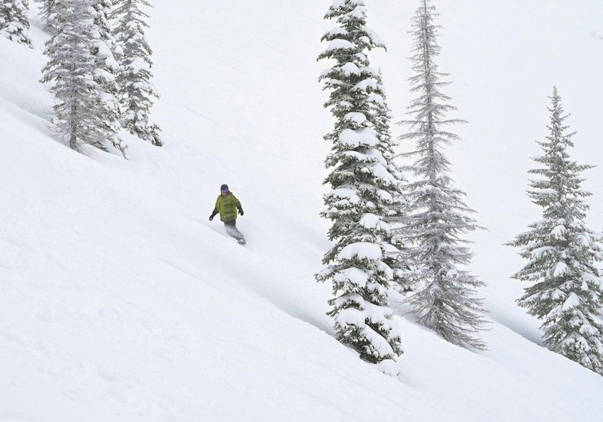
The weekend finally has an honest powder story.
It is in New Zealand.
Australia is better too. That matters. Perisher is spinning more lifts, the groomer count jumped, snowmaking had another cold overnight run, and the Tuesday-Wednesday storm did real repair work. But the first weekend of August is not a clean "winter is back" moment on both sides of the Tasman.
It is a split decision.
Mountainwatch's July 31 Australian forecast says Australian resorts just had their best conditions of the season after 15-20cm from the midweek storm, cold temperatures, and heavy snowmaking. Fine weather now carries the weekend, with another weak front possible Monday-Tuesday and 5-15cm on the cards.
That is useful.
New Zealand has the sharper headline. Mountainwatch's July 31 New Zealand forecast has fresh snow overnight, an icy southerly delivering 5-10cm to most South Island ski fields Friday, up to 15-20cm for The Remarkables, and 10-35cm+ for Mt Ruapehu. Treble Cone's July 31 report via OnTheSnow is the loudest proof point: 40cm of new upper-mountain snow in 24 hours, powder up top, and 2 of 3 lifts open.
That is the difference.
Australia has a better product than it had last weekend.
New Zealand has the day people set alarms for.
40cm
Treble Cone upper-mountain new snow
25cm
Remarkables last 48 hours
34
Perisher lifts set to spin
51
Perisher groomed runs
New Zealand Has the Real Powder Problem
This is the best kind of ski problem: too much weather first, better skiing next.
The Remarkables was closed Friday, and that matters. The resort's own report had the mountain and road closed, chains required for all vehicles, 25cm in the last 48 hours, a 20-95cm base, and off-piste marked as powder. The evening update was even more direct: groomers were reporting 20-30cm of wind-affected new snow, with more still falling, and Saturday was looking much better.
That is not a failure.
That is storm sequencing.
Friday is the mountain doing the work: road crews, grooming teams, patrol, wind loading, access, drifting, and all the unglamorous stuff that turns snow into a ski day. Saturday is the payoff if the road opens and the wind behaves.
The lift board is also worth reading carefully. The Remarkables page still lists 7 of 7 lifts and 100% terrain in the underlying status blocks, but the mountain status is closed for Friday. That is exactly why "open lifts" is not the whole forecast. Access and wind are part of the product.
Still, this is the right kind of setup.
Cold snow. Full operating infrastructure waiting underneath. A Saturday weather improvement. Powder language that is not just a marketing department trying to rescue a bad week.
Treble Cone Is the Alarm-Clock Mountain
Treble Cone is the most interesting mountain in the Southern Hemisphere today.
Not the safest. Not the smoothest. The most interesting.
The OnTheSnow report, sourced from the resort, calls Friday a powder day with 40cm of new snow on the upper mountain in the previous 24 hours. It also says the snow is light and dry up top, denser at the base, and still falling. That is the kind of vertical snow-quality split Treble Cone can make fun if you are skiing the right terrain, and awkward if you are expecting every turn to feel the same.
The operational fine print is the whole point. Home Basin was aiming to open by 9 a.m. Saddle Basin was staying closed, winds were expected to build, and only a small groomed set was listed: Triple Treat, Main Street, and the Beginner Platter.
So the SnowRadar read is simple:
Treble Cone is the powder call if you can handle the conditions.
It is not the lazy travel call.
That distinction matters because Wanaka often gets sold as a clean two-mountain hedge: Cardrona for dependable laps, Treble Cone for the bigger terrain. This weekend, that hedge is especially useful. If Treble Cone's wind and lift constraints get annoying, Cardrona gives the region a fallback. If Treble Cone lines up, it is the mountain with the ceiling.
That is why Wanaka probably has the highest upside of the weekend.
Ruapehu Is the Chaos Card
The North Island is finally back in the conversation.
Mountainwatch has Mt Ruapehu in line for another 10-35cm+ as westerlies keep snow falling through Friday, with snow lowering to base levels before clearing Friday evening. The broader Mountainwatch snow report board also shows the biggest seven-day forecast numbers in New Zealand clustered around Ruapehu: Tukino, Whakapapa, and Turoa all listed at 51cm.
That is a real signal.
It is also Ruapehu, so nobody gets to turn off their brain.
Wind, visibility, access, volcanic-plateau exposure, and lift reliability can all take a good snowfall forecast and make it complicated fast. But if you are watching pure storm upside, Ruapehu has more than a cameo this weekend.
The practical call: South Island resorts have the cleaner destination pitch. Ruapehu has the bigger "watch this" number.
Australia Finally Gets a Good-Looking Weekend
Australia deserved a better headline than it has had for most of July.
It finally gets one.
Perisher's July 31 official report is the best Australian proof point: 185 snow guns ran overnight, Hume and Burke T-Bars opened in Smiggins on Thursday, Blue Cow T-Bar and the Carpark Double Chair were set to open in Guthega, and the resort expected 34 lifts to spin. The groomed count was the eye-opener: 51 groomed runs.
That is a very different product than the thin-lane survival skiing Australia was selling in June.
Perisher also reported 15cm over seven days and an 88cm natural depth, with current temperatures around -6C on the mountain when the report was captured. Snow-Forecast's Perisher report had 34 of 47 lifts, 36 of 65km of pistes, packed powder and groomed snow, plus 88cm upper and 50cm lower depths.
That is credible.
But the official Perisher report also includes the sentence that keeps this honest: the best skiing and riding remains in snowmaking areas, and coverage may be thin elsewhere.
There it is.
Australia has a good weekend. It does not have a blank check.
Best Conditions of the Season Is Not the Same as Normal
Mountainwatch's Australian phrase is important: best conditions of the season.
That can be true and still not mean the season is fixed.
The Australian Alps came into this week carrying a lot of damage: warm spells, marginal lower slopes, confidence issues, and a July that kept reminding people how fragile the snowpack was. A 15-20cm storm plus cold snowmaking can dramatically improve the guest product. It cannot rewrite the base history.
That is why Perisher is the Australian pick. Scale matters more in a thin year. A big resort with 34 lifts and 51 groomed runs can absorb weak spots better than a smaller footprint can. It can move skiers around. It can lean on snowmaking. It can make a managed winter product feel like a proper day out.
Thredbo, Hotham, Falls Creek, Buller, and Baw Baw all benefit from the same cold reset, but the value equation is different at each. The Mountainwatch snow reports board had clear, cold Friday morning language across the Australian resorts: Perisher at -5.9C, Thredbo cold and clear, Falls Creek preserving dry snow, Hotham calling it a great way to send off July.
That is good.
It is also a groomer-first weekend unless your local report says otherwise.
The Long-Range Warning Is Still Ugly
Australia's weekend weather is pleasant. Australia's seasonal signal is less cute.
The Bureau of Meteorology's long-range outlook issued July 30 says August to October rainfall is likely to be below average across much of the east and south-west, daytime temperatures are likely above average south of the tropics, and overnight temperatures are likely above average for most of the country. The same outlook says El Nino is firmly established and continuing to strengthen.
That does not cancel this weekend.
It explains why this weekend matters.
Australian resorts have to cash in every cold window now. When snowmaking temperatures arrive, use them. When the groomers get a clean overnight freeze, use it. When a weak early-week front offers another 5-15cm, take it. But the broader backdrop says this is still a defensive season.
New Zealand is not immune from warm/rain phases either. The July 31 front had marginal pieces before the colder air took over, and Canterbury had widespread closures Thursday as the northwesterly front hit. But the current operating floor is better. Snow-Forecast's July 30 Southern Hemisphere roundup had New Zealand with up to 40cm from its best week in several weeks and most resorts 80-100% open, while Australia still had much smaller terrain percentages at many resorts.
The weekend did not create that gap.
It exposed it.
The SnowRadar Weekend Call
If you are already in Australia, ski.
Seriously. This is the weekend to stop doomscrolling the season and take the best managed product available. Perisher is the domestic call because it has the lift count, grooming count, snowmaking scale, and enough resort footprint to make the repair storm count. Thredbo is worth watching if winds stay mellow and upper-mountain operations hold. Victoria should be treated as a cold groomer and snowmaking rebound story, not a broad natural-snow guarantee.
If you are choosing a destination from scratch, New Zealand wins.
Wanaka has the upside because Treble Cone just got the kind of snow that changes a mountain, while Cardrona gives the region a practical fallback. Queenstown has the Saturday powder setup if The Remarkables road and wind situation resolves cleanly. Canterbury remains the reliability play if Mt Hutt keeps its strong operating board intact. Ruapehu is the chaos card with the biggest forecast number.
That is the map.
Australia finally gets a good weekend.
New Zealand gets the powder weekend.
In a season this uneven, that difference is the story.
What To Watch Next
Watch The Remarkables Saturday morning report. Friday's closure is acceptable if it turns into a clean access-and-powder day.
Watch Treble Cone's Saddle Basin. Forty centimeters is exciting, but the best terrain only matters if the lift and wind situation cooperates.
Watch Perisher's lift count. If 34 holds through the weekend, Australia has a real anchor.
Watch Australian snowmaking hours. The natural snow helped. The guns may decide how long the improvement lasts.
Watch the Monday-Tuesday front. Another 5-15cm in Australia would keep the repair trend alive. A miss would put the season back on grooming and snowmaking defense.
And watch the August 8-10 window. Mountainwatch sees another possible storm series then, but the details are unresolved. That is too far out to trust and too important to ignore.
SnowRadar call: ski Australia if you are there, book New Zealand if you are choosing, and keep one eye on August because the Southern Hemisphere season is finally interesting again.