New Zealand Wins the Weekend. Australia Gets a Repair Job.
Late July finally has colder air on both sides of the Tasman, but New Zealand has the cleaner ski pitch while Australia is still fixing the damage from a record-warm week.
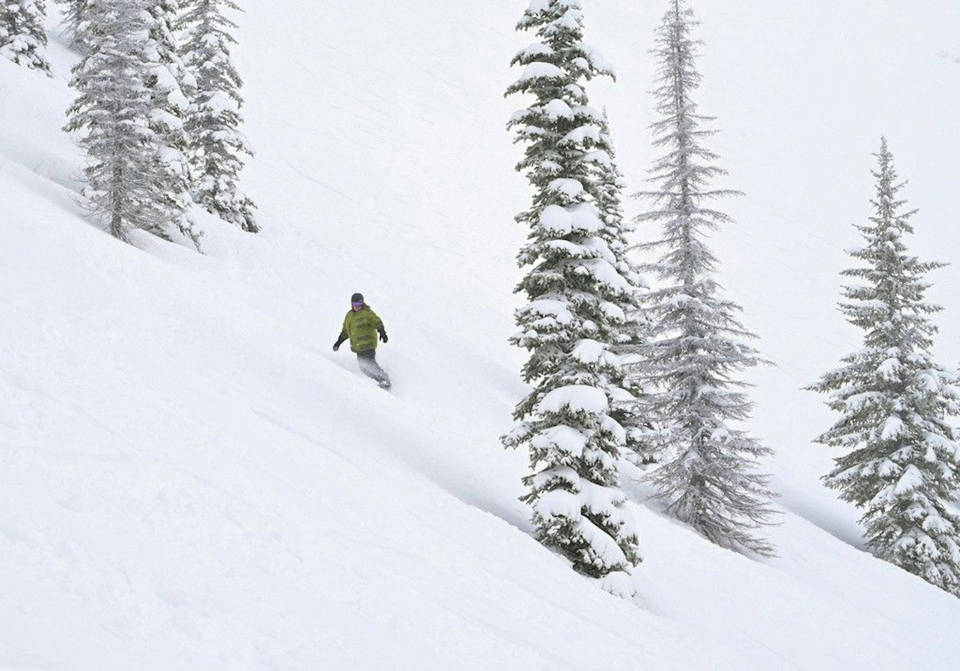
This weekend has a winner.
It is New Zealand.
Not because Australia is unskiable. It is not. Perisher has a real operating map, Thredbo is cold again, Hotham and Falls Creek are getting snowmaking air, and the next system should add something useful early next week.
But the late-July ski pitch is not just "where can I slide on snow?"
It is confidence.
After a week where Australian alpine resorts set July heat records, Australia is selling a repair job. Perisher's July 24 report has 29 lifts scheduled, 34 groomed runs, 2cm of fresh snow, and 201 snow guns running overnight. That is a genuinely useful recovery setup. It is also a reminder of how much work the mountain still has to do.
New Zealand, meanwhile, has the cleaner story. Mountainwatch's July 24 New Zealand forecast has the Southern Lakes picking up a small 2-5cm shot, Canterbury scoring 5-15cm, Ruapehu potentially landing 15-30cm, and high pressure building Sunday into Tuesday. The same forecast table puts Treble Cone at 39cm over seven days, The Remarkables at 19cm, and Mt Hutt at 13cm.
That is not a legendary dump.
It is enough to win the weekend.
29
Perisher scheduled lifts
34
Perisher groomed runs
39cm
Treble Cone 7-day forecast
5-15cm
Canterbury weekend range
Australia Is Back in Winter, But Not Back to Normal
The Australian Alps badly needed this colder reset.
They got it.
Mountainwatch's July 24 Australian forecast says winter returned Thursday with a light dusting, west-to-southwest winds should keep snow showers moving through the weekend, and a colder Tuesday-night change could bring a 5-15cm powder shot. More important than the natural snowfall, cold temperatures should let snowguns run hard after a week that felt much too much like spring.
That matters because Australia's problem was never simply "no snow."
It was trust.
The Guardian's heat-record story was brutal because it named the exact places skiers were already worried about. Hotham hit 12C in July. Falls Creek reached 13C. Thredbo hit 14C. Those are not harmless shoulder-season numbers. They are midwinter credibility wounds.
So yes, this weekend should ski better than last weekend.
But "better than record heat" is not the same thing as "fully reset."
Australia's best plan is early starts, groomed terrain, cold-manufactured surface, and realistic expectations. If you get a soft refill, enjoy it. If you get a firm corduroy morning, take the win. If you see rope lines, thin cover warnings, or wind holds, believe them.
This is still a season where operations matter more than optimism.
Perisher Remains the Australian Anchor
If Australia has a credible late-July argument, it starts at Perisher.
The July 24 report is exactly the kind of operational note the season needed: 2cm of fresh snow, a Valley temperature of -3.7C, snowmaking from 201 guns, 34 groomed runs, and 29 lifts scheduled across the resort. The surface call is also honest: firm and fast, with a man-made layer on top.
That is the right pitch.
Not powder theater. Not "winter is back" chest-thumping. A broad resort footprint, enough grooming to spread people out, cold air, and snowmaking scale.
Perisher's advantage is size. In a thin, variable Australian season, size becomes risk management. More lifts mean more ways to dodge crowds. More groomed runs mean more ways to find a decent surface. More snowmaking means more ways to patch the base after heat.
The warning is wind.
Perisher flagged possible wind impacts Friday, and Mountainwatch has brisk west-to-southwest winds hanging around into the weekend. That is the fine print for the whole Australian side: the cold is helpful, but cold plus wind can make lift reliability and comfort a real part of the day.
For weekend skiers, Perisher is still the domestic pick.
It just needs to be treated like a managed winter product, not a natural-snow miracle.
Thredbo Has Lift Count, But the Surface Is the Story
Thredbo looks better on paper than it did a month ago.
Snow-Forecast's current Thredbo report shows 14 of 15 lifts open and 17.5km of pistes available. Mountainwatch's Thredbo report had a properly cold Friday morning, with the village around -2C, the top around -6C, and a strong WSW wind pushing wind chill into ugly territory.
That is real winter air.
The caveat is that Snow-Forecast lists the piste state as artificial snow cover. That phrase is not an insult. It is the business model this week.
Thredbo's strongest terrain needs coverage and continuity. A cold, groomed, mostly lift-served weekend can be very fun. But after the 14C heat record, this is not the moment to overpromise lower-mountain softness or off-piste depth.
The right Thredbo day is tactical: check wind, ski the best surface early, avoid chasing hero lines through marginal cover, and let the resort's lift network do the work.
That is not romantic.
It is useful.
Hotham and Falls Creek Are Rebuilding the Base Account
Hotham and Falls Creek have a more delicate assignment.
Both were called out in the heat-record week. Both need cold nights as much as fresh snow. Both can improve quickly when snowmaking runs, but neither should be read as fully healed because the thermometer finally behaved.
Hotham's July 24 backcountry note is a good reality check: significant sliding hazard, thin cover, marginal lower elevations, and icy dangerous aspects. Its lifts and terrain page showed 8 of 14 lifts, 24 of 105 trails, and 16 groomed trails issued Friday night.
That tells you how to ski it.
The groomed, controlled product is the product. The adventurous-looking terrain is not automatically ready just because the calendar says late July.
Falls Creek is slightly more utilitarian this week. Mountainwatch's Falls Creek report had cold air, good snowmaking conditions, a 3cm natural top-up, and very firm snow. Skiresort.info's Falls Creek snapshot had 10 of 15 lifts, 10.4km of 49km open, and a base around 30-39cm.
That is a resort making the best of a thin ledger.
The practical call: Hotham and Falls Creek can deliver useful groomer days this weekend. They are not the best bet if your idea of value requires big open terrain, forgiving off-piste, or zero logistics friction.
New Zealand Has the Better Weekend Shape
New Zealand is not perfect.
It is just easier to believe.
The Southern Lakes had a messy front first, then colder air. Canterbury gets the better weekend snow window. Ruapehu is the high-upside chaos card. By Sunday, the pattern turns friendlier: colder, clearer, lighter wind, and snowmaking windows continuing into the start of next week.
That is what a ski region wants after a rough start.
The most important part of the Mountainwatch New Zealand forecast is not the raw centimeter count. It is the sequence:
Mess first.
Cold snow second.
High pressure third.
That gives resorts a chance to take the refresh and then actually operate it. A windy storm day can make for good marketing and lousy skiing. A smaller storm followed by a calm cold day is often the better guest product.
For Queenstown, that points to The Remarkables. Snow-Forecast's Remarkables report has 7 of 7 lifts open and fresh snow across the ski area. Skiresort.info has 17 of 20km open, which is about 85% of slopes.
That is a clean headline.
For Wanaka, the more interesting piece is Treble Cone. The seven-day forecast number is the standout on Mountainwatch's table: 39cm. Forecasts are not bank deposits, and Treble Cone always needs enough coverage to make its better terrain ski honestly. But if you are looking for the higher-upside late-July pitch, this is where your eyes go.
For Canterbury, Mt Hutt gets a nice weekend lane: 5-15cm possible in the region, then colder clearer weather. Snow-Forecast's Mt Hutt report has 5 of 5 lifts open and 30 of 35km of pistes open. That may be the most dependable New Zealand operating card in the whole comparison.
The Road and Access Test Still Matters
The lazy way to do this story is Australia versus New Zealand by snowfall total.
That misses the thing travelers actually feel.
A ski weekend is not a forecast table. It is roads, wind, lifts, grooming, lines, rental pickup, village movement, and whether the snow at 1 p.m. is still fun or has become a negotiation.
Australia's road/access test is mostly about friction. If the mountain is expensive and the snowpack is thin, small hassles feel bigger. A wind hold feels bigger. A chain rule feels bigger. A marginal return trail feels bigger. People are less forgiving because the value equation is already under stress.
New Zealand's access test is different. Queenstown and Wanaka can sell a whole trip even when one mountain has weather problems. The Remarkables, Coronet Peak, Cardrona, and Treble Cone give travelers more ways to pivot. Mt Hutt has its own road-risk personality, but when it is open with most terrain operating, the product is strong.
That is the reason New Zealand wins the weekend.
Not because every skier gets powder.
Because it has more ways to turn the forecast into a believable trip.
The SnowRadar Weekend Call
If you are already in Australia, ski Perisher first. It has the scale, the lift count, and the snowmaking muscle to make this repair window feel like a real ski weekend. Thredbo is viable if wind cooperates and you stay disciplined about surface timing. Hotham and Falls Creek are groomer-first calls with important fine print.
If you are choosing where to spend late-July ski money from scratch, pick New Zealand.
The Remarkables has the cleanest operating signal. Mt Hutt has the strongest dependable-terrain card. Treble Cone has the highest upside if the next-week forecast verifies. Cardrona remains the glue mountain for Wanaka because it can keep the trip useful even when the wilder terrain needs more snow.
Australia gets a better weekend than it deserved after the heat records.
New Zealand gets the better pitch.
That is the difference.
What to Watch Next
Watch Perisher's lift count. If it stays near the high-20s and the groomed count holds, Australia has a credible anchor through the weekend.
Watch Thredbo wind. The lift count is strong, but west-to-southwest wind can edit the guest experience fast.
Watch Hotham's open terrain against its hazard language. More lifts are good. Honest warnings are better.
Watch Falls Creek snowmaking and road/access reports. Cold air can make the groomers much better, but logistics still matter.
Watch The Remarkables because 7 of 7 lifts is the simplest New Zealand signal.
Watch Mt Hutt because full lift operation plus a Canterbury top-up could make it the most reliable call.
Watch Treble Cone because that 39cm seven-day forecast is the upside number that can change Wanaka's whole mood.
And watch next Wednesday.
Both countries have more weather on the board then. Australia needs that 5-15cm reset to verify. New Zealand has the better chance to turn a decent weekend into a genuine late-July run.
SnowRadar call: New Zealand by confidence, Australia by effort.