Week Ahead: Australia Finally Has a Forecast Worth Watching
The first full week of August has a real Southern Hemisphere split: New Zealand owns the reliable ski product, while Australia gets the storm signal it has been waiting for.
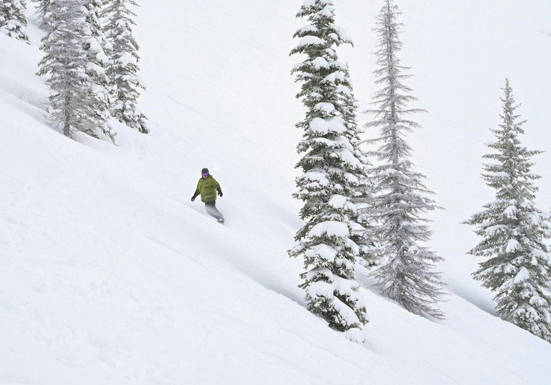
August is finally acting like August.
That is the good news.
The catch is that the better story is split across the Tasman. New Zealand has the usable product right now: strong lift boards, real base numbers, and a clean midweek window. Australia has the more interesting forecast: light refills early, cold snowmaking weather, then a bigger weekend storm signal that could turn the season from "managed recovery" into something closer to normal winter.
That does not mean Australia is suddenly fixed.
It means Australia finally has a week worth watching.
Mountainwatch's August 3 Australian forecast has light snow showers from Monday into late Wednesday, totaling around 5-15cm, with cold temperatures keeping the snow guns useful. Then high pressure brings a sunny Thursday-Friday reset before a stronger storm system lines up from Saturday night into Monday.
New Zealand is different. Mountainwatch's August 3 New Zealand forecast says the Southern Lakes scored 15-40cm from the late-week storm cycle, Canterbury fields picked up 10-25cm, and Mt Ruapehu's seven-day totals reached 70cm at Turoa. The week ahead brings smaller top-ups Monday-Tuesday, then crisp bluebird days through midweek.
So here is the SnowRadar read:
New Zealand is the better place to ski this week.
Australia is the better place to watch for a turn.
5-15cm
Australia Mon-Wed forecast
15-40cm
Southern Lakes recent storm
80cm
Top Mountainwatch 7-day forecast
7/7
Remarkables lifts open
Australia Gets the Setup It Needed
Australia's early August forecast is exactly the kind of sequence a bruised season needs.
Not one heroic dump.
A repair pattern.
Mountainwatch has Monday as windy and unsettled, with light snow showers building overnight as colder air arrives. Tuesday keeps the flakes going, with cold west-to-northwest winds helping snowmaking. Wednesday dries out as the wind eases. Thursday and Friday look like the groomer-payoff days: colder mornings, little wind, and high pressure doing the thing skiers actually want high pressure to do.
Then the bigger question arrives.
The extended forecast has a stronger storm system from Saturday night into Monday, followed by more possible midweek systems. That is too far out to treat as a locked powder weekend. It is also too meaningful to ignore, because Australia's winter has not had many chances to stack natural snow on top of a cold, freshly repaired surface.
The difference between this week and the false starts of June and July is sequencing.
Australia got a midweek storm last week. Resorts used cold nights to rebuild groomers. Now another light top-up arrives before the next larger system. If the weekend storm holds together, it will be landing on a snowpack that is at least in better shape than it was two weeks ago.
That is not hype.
That is how fragile seasons become skiable.
But Wind Is Already Writing the Fine Print
The annoying part: wind is not a footnote. It is the operational story.
Perisher's August 3 official report had 49 groomed runs ready for Monday laps and 33 lifts scheduled to spin, but also warned that strong winds could affect lift operations. Mountainwatch's live snow-report board later showed the sharper version: an 8:15 a.m. wind-hold update with all chairlifts except Village 8 and Kaaten Triple at Smiggins on hold.
That is the whole Australian week in one sentence.
The product is improving. The atmosphere is still bossy.
Thredbo had the same problem. Its August 3 report listed a stack of expected lifts, including Karels, Basin, Antons, Merritts Gondola, Kosciuszko, Gunbarrel, Cruiser, and Easy Rider, but opened with the warning that strong winds were forecast. Mountainwatch's Thredbo report was blunter: at 8:15 a.m., all lifts other than Friday Flat lifts were on wind hold, with top-station winds reported around 72-91km/h earlier in the morning.
That does not make the snow irrelevant.
It makes timing everything.
If you are skiing Australia early this week, the best plan is not "follow the snowfall map." It is "watch the lift board, ski the sheltered groomers when windows open, and save your expectations for Thursday-Friday if the wind relaxes."
The storm matters.
Access matters more.
Perisher Is Still the Australian Anchor
Perisher remains the Australian call because scale matters in thin or messy years.
The official report's 49 groomed runs and 33 scheduled lifts are not perfect when wind holds interfere, but they are still the strongest operating base in the country. A big resort can spread people out when pieces of the mountain open. It can lean on snowmaking. It can patch, groom, reroute, and give skiers more ways to find a decent day.
That matters in a season where the natural snowpack has needed help.
The lesson from late July is that Australia's best days are probably going to be built, not simply delivered. The storms matter, but the resorts that can turn 5-15cm into better groomers and preserve it through cold nights are the ones that will win the week.
That makes Perisher the safest Australian bet.
Thredbo has the more dramatic topography and can ski beautifully when the upper mountain is behaving, but today's wind holds are the reminder. If the upper lifts are down, the mountain changes fast. Hotham and Falls Creek should benefit from the same cold and refill pattern, but their value depends on exact wind exposure, snowmaking windows, and how much of the coming weekend storm verifies.
Australia's short version:
Ski when the lift board says yes.
Do not buy the storm before it lands.
New Zealand Already Has the Product
New Zealand does not need the same leap of faith this week.
The Remarkables is the cleanest example. The resort's August 3 report listed the mountain open, road open, chains carried, 28cm in the last 72 hours, a 20-95cm base, 107cm of season snowfall, 7 of 7 lifts open, and tracked powder off piste.
That is a real ski product.
Not perfect. Windy enough to deserve attention. Not bottomless. Not a free pass to ignore patrol ropes. But after the delayed-openings mess of June, "7 of 7 open with recent snow" is a very different conversation.
Snow-Forecast's Remarkables report lines up with the operating story: 7 of 7 lifts, 18 of 20km of pistes, packed powder and groomed snow, and model-estimated mid-mountain snowfall around 24cm from July 29-31.
Mt Hutt is the reliability card. Snow-Forecast's Mt Hutt report had 5 of 5 lifts open, 26 of 35km of pistes open, packed powder and groomed snow, with upper and lower depths listed at 66.5 inches and 41.7 inches.
That is not as flashy as a powder headline.
It is often more useful.
If you are planning a trip, Mt Hutt's appeal is that it does not need a heroic forecast paragraph. It has depth, lifts, groomed product, and a colder midweek window. That is how you sell confidence.
The Southern Lakes Have the Ceiling
Queenstown and Wanaka are still the more interesting travel story.
The Remarkables has the clean lift board. Treble Cone has the storm-cycle upside. Cardrona gives Wanaka a more practical fallback when Treble Cone's exposure, wind, or terrain mix gets complicated. Coronet Peak is the convenience piece for Queenstown, especially if weather or road timing makes a shorter day smarter.
This is what New Zealand has that Australia is still rebuilding: options.
The Mountainwatch forecast has the Southern Lakes clearing into a sunny Tuesday, then a crisp, clear Wednesday and another beautiful Thursday before a Friday front brushes the western side of the South Island. That is a good skier rhythm. Fresh snow first, visibility next, then a small refresh possibility for the Main Divide resorts.
The caution is that the next big signal for New Zealand is not immediate. Mountainwatch sees high pressure dominating well into next week, with more active storms potentially returning around mid-August. So this week is less about chasing a new dump and more about using the snow that just arrived.
That is fine.
The snow already arrived.
Ruapehu Is the Wild Card Again
Mt Ruapehu is back in the conversation, and that alone is notable.
Mountainwatch says Turoa reached a 70cm seven-day total, while Whakapapa and Turoa both picked up snow from the late-week storm cycle. The August 3 forecast gives Ruapehu more snow Monday-Tuesday as cold southerlies arrive, with winds strong enough to affect lift operations, then a good-looking Thursday.
That is classic Ruapehu: big upside, big operational caveat.
If you are local, this is worth watching closely. If you are planning from farther away, the South Island still has the cleaner risk profile. Ruapehu's storm numbers can be louder, but wind, visibility, and lift reliability can turn loud numbers into a complicated day fast.
Still, it belongs on the board.
After a weird start to winter, New Zealand now has multiple regions worth checking each morning. That is a big shift from June's "which resort can open anything?" anxiety.
The SnowRadar Week-Ahead Call
If you are choosing where to ski this week from scratch, choose New Zealand.
The Remarkables has a full lift board and recent snow. Mt Hutt has reliability. Wanaka has the best ceiling if Treble Cone lines up. Ruapehu has the biggest chaos number, but also the biggest operations caveat.
If you are already in Australia, do not write the week off.
Monday is a wind-management day. Tuesday and Wednesday are light-refill days. Thursday and Friday are the likely groomer payoff. The weekend is the real watch point, because a Saturday-night-to-Monday storm could finally give Australia the kind of August reset it has been missing.
The ranked call:
- New Zealand for confidence.
- Perisher for the Australian anchor.
- Wanaka/Queenstown for upside.
- Ruapehu for the wildcard.
- Australia next weekend if the stronger storm survives the forecast window.
That last line is the interesting one.
For most of July, Australia's forecast felt like damage control. This week, it has a pathway. Not a guarantee. Not a full-season rewrite. A pathway.
That is enough to make August worth watching.
What To Watch Next
Watch Australia's wind holds through Monday and Tuesday. If the snow arrives but the upper lifts stay closed, the useful ski window shifts later.
Watch Perisher's groomed count. If it holds near 49 groomed runs after the light refills, Australia has a real managed-skiing platform.
Watch Thursday morning. Cold, low-wind groomers after a few days of light snow could be Australia's best simple ski day of the week.
Watch the weekend storm. The current signal is promising from Saturday night into Monday, but it needs to survive another couple of forecast cycles before anyone should plan powder around it.
Watch The Remarkables road and wind language. A 7 of 7 lift board is excellent. It still has to stay operational.
Watch Mt Hutt because boring reliability wins trips.
And watch mid-August in New Zealand. If high pressure dominates for too long, the current snow has to carry the product. If the next active pattern shows up around August 14, New Zealand could move from "best option" to "proper winter."
SnowRadar call: New Zealand is the week. Australia is the watch. If the weekend storm verifies, next Monday's headline gets a lot more fun.