Australia Finally Got Snow. That Does Not Erase June.
Perisher, Thredbo, Hotham, and Falls Creek finally picked up a real July dump after one of Australia's worst starts in decades. The question is what survives into school holidays.
Australia finally got the snow report it has been waiting for.
Not a dusting. Not a marketing-friendly webcam angle. Not a groomed strip held together by heroic snowmaking.
Actual snow.
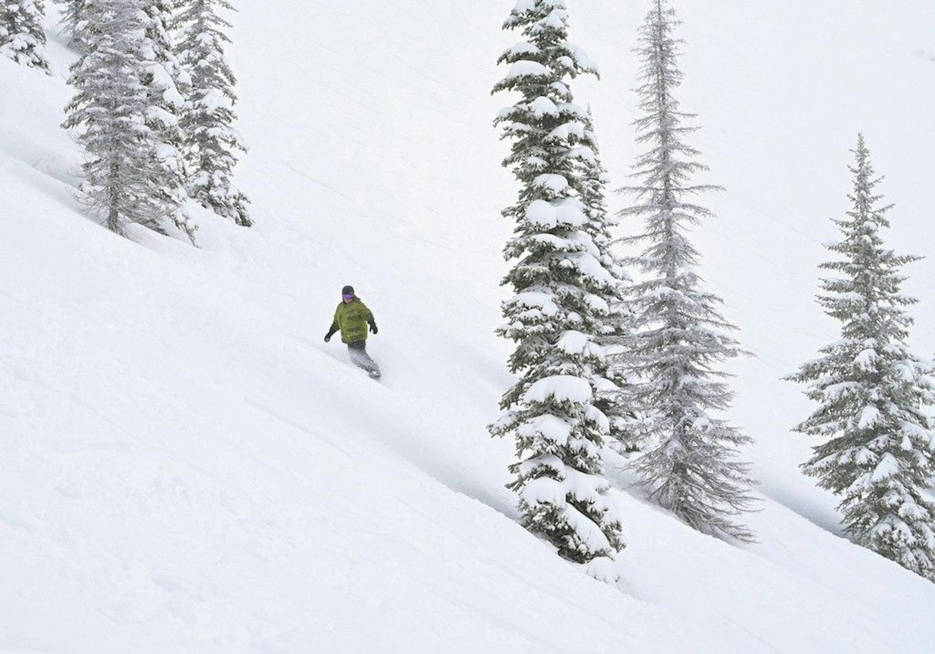
ABC News reported that by early Friday morning, 15-20cm had stacked up on the higher slopes at Thredbo, Perisher, Mount Hotham, and Falls Creek, with another 10-20cm possible before the storm cleared. The Guardian had the same basic shape: close to 30cm in parts of the NSW and Victorian alpine zones after a mostly snowless start to winter.
That is good news.
It is also not a reset button.
The important thing about this storm is not that Australia got white again. It is that the snow arrived after a warm, rain-hit, wind-battered June that left the resorts trying to sell winter with very little winter attached. This dump buys time. It gives operators a shot at opening more terrain for school holidays. It lets snowmaking run in colder air. It makes the webcams look sane again.
But after the start Australia just had, one storm does not fix the season.
It changes the argument.
15-20cm
Friday morning higher-slope snow
10-20cm
More possible Friday
10-30+cm
Mountainwatch Friday forecast
1957
Worst-start comparison year
This Was a Rescue Storm
Australia did not need a powder day.
Australia needed an intervention.
ABC's weather write-up put the start in brutal historical context: 1967 had a near-snowless June before snow arrived July 1, while 1957 did not see meaningful accumulation until the second week of July. That makes 2026 a legitimate candidate for the worst Australian ski-season start in almost 70 years.
That is the part that makes Friday's snow more than a pleasant update.
This was a calendar rescue.
School holidays are starting. Thousands of families have trips booked. Resorts have been operating on the thinnest possible early-season product: beginner zones, snowmaking lanes, sightseeing, lessons where possible, and a lot of careful language. A normal early July storm is useful. This one is strategic.
Mountainwatch's Friday forecast was blunt in the right way: after several days of heavy rain and strong winds, Friday was finally the first decent snowstorm in a long time, with a projected daily total of 10-30+cm, mainly on mid and upper slopes above about 1700m.
That elevation detail matters.
The higher terrain gets the real benefit. Lower slopes get less. Beginner zones may improve, but the best operational gains are likely where the snow falls cold enough, deep enough, and wind-loaded enough to turn into coverage rather than decoration.
That is the useful read.
Not "Australia is back."
"Australia finally has something to work with."
The Warm June Damage Is Still the Story
The snow is exciting because the lead-in was so ugly.
ABC reported Australia's June mean temperature was 1.5C above the 1961-1990 baseline, and that the eastern states ran 2.17C above that baseline. In ski terms, that means the atmosphere kept refusing to behave like winter where resorts needed it most.
The Guardian quoted the Bureau of Meteorology saying the atmosphere had been too warm for snow except on the highest peaks. That is the whole problem in one sentence.
Australia does not have endless elevation to spend.
When freezing levels sit too high, the resorts do not merely miss snowfall. They get rain on the limited snow they already have. Rain is not neutral. It strips cover, saturates thin lanes, blows up grooming plans, and leaves snowmaking crews trying to rebuild the same surfaces again and again.
That is why Friday's 15-30cm has to be graded on a curve.
Twenty centimeters falling onto a durable base is one thing. Twenty centimeters after heavy rain and a warm June is another. Some of the new snow becomes skiable improvement. Some becomes repair. Some becomes the emotional relief everyone needed after staring at brown patches for too long.
All three are real.
But they are not the same.
Perisher and Thredbo Got the Headline
The NSW resorts are the easiest way to understand the storm.
Perisher had been limping through a narrow product. Thredbo had been leaning hard on Friday Flat and snowmaking. Neither mountain needed another "winter is coming" forecast. They needed snow on the ground, colder air, and enough follow-up snowmaking time to turn the storm into actual terrain.
Friday delivered the first two.
Mountainwatch's snow report board had Thredbo reporting 10-15cm above 1700m early Friday, with Perisher also reporting snow after the cold front finally arrived. The official resort pages and cams were moving fast through the storm cycle, but the broader signal was consistent across ABC, Guardian, and Mountainwatch: NSW finally got the dump that turns a desperate school-holiday setup into a workable one.
Workable is the key word.
Do not expect this to instantly unlock the full mountain. That is not how thin early-season snowpacks work. Patrol still has to assess coverage. Groomers still need enough depth to push without scraping. Wind can help some aspects and punish others. Lower-elevation connections remain more fragile than upper-mountain pockets.
But compared with where Australia was earlier this week, the difference is huge.
Perisher and Thredbo now have a path.
Before Friday, they mostly had patience.
Victoria Needed This Just As Badly
The Victorian resorts were in the same boat.
The Guardian reported Mount Hotham had 30cm of fresh snow in 48 hours and was still seeing snow come down Friday. Mountainwatch's snow report board showed Falls Creek with 17cm on the ground and 14cm overnight early Friday, while Mt Buller and Mount Baw Baw were also reporting a proper winter look after the front moved through.
That matters because the Australian ski story often gets flattened into Perisher/Thredbo shorthand.
This storm was broader than that.
It hit the NSW Snowy Mountains and the Victorian Alps at the moment both needed operational oxygen. Hotham and Falls Creek, especially, needed the visual and physical reset. Cold smoke marketing is one thing. White roads, buried grass, and snow guns firing into genuinely cold air are another.
Again, the question is not whether the resorts can post prettier photos.
They can.
The question is whether they can turn this into enough reliable terrain to survive the school-holiday surge without every guest feeling like they are sharing the same two ribbons.
That is the next scoreboard.
New Zealand Is the Contrast, Not the Main Event
New Zealand has been the main Southern Hemisphere story for weeks because the delays there were louder and more visible. Cardrona, The Remarkables, and Mt Hutt all had to fight their way out of a bad June start, and the last SnowRadar update framed July as the first real stress test.
That is still true.
But today's pivot belongs to Australia because the cold side finally arrived after the warm, wet punch. New Zealand's problem right now is expansion. Australia's problem was more basic: get enough natural snow to make the season feel real.
The Remarkables still shows the useful nuance. Its July 3 report had lifts including Shorty Conveyor, Tahi Conveyor, Rua Conveyor, Alta Chair, and Sugar Bowl Express set to open from 9am, while Curvey Basin Express and Shadow Basin Chair remained closed. That is progress, but it is still a partial mountain. Advanced, expert, park, and access terrain remain heavily qualified.
That is the same lesson in a different country.
Open is not enough.
Open enough is the question.
The Forecast Gives Resorts a Window
The best part of the Australian forecast is not only Friday's snow.
It is what follows.
Mountainwatch expects colder southerlies to wind down, skies to clear, and several good snowmaking windows through the weekend and early next week. That is exactly what resorts need after a repair storm. The storm puts material on the hill. The cold nights let crews lock it in, fill weak points, and build the lanes that can handle real skier traffic.
There is also a possible next system around July 12-13, according to Mountainwatch, with models starting to line up for another shot of snow and cold temperatures.
That is not close enough to count as a win yet.
It is close enough to matter.
Australia does not need one viral storm. It needs sequence. Snow, cold nights, snowmaking, terrain expansion, another refresh, then more cold. That is how a season climbs out of a bad start.
Friday was the first believable step.
What Skiers Should Actually Watch
Snowfall totals are the headline. Terrain is the product.
For the next 72 hours, the useful numbers are not just storm totals. Watch lift counts, groomed-run counts, lower-mountain access, beginner-zone capacity, road conditions, and whether resorts stop using emergency early-season language in their daily reports.
If Perisher and Thredbo can turn Friday's snow into more lifts and more groomed terrain before the holiday rush fully lands, this storm did its job.
If Hotham and Falls Creek can preserve the higher-slope gains and keep snowmaking running, Victoria gets a real early-July reset.
If lower slopes wash thin again or the new snow skis like a cosmetic layer on top of an injured base, the season is still fragile.
The good version is now possible.
That was not true a week ago.
SnowRadar Take
Australia finally got the storm it needed.
But the smartest read is still skeptical optimism.
This was not a normal powder cycle landing on a healthy base. It was a rescue storm after a historically bad start, an overheated June, rain damage, and too many early-season products that were technically open but practically tiny.
That does not make the snow less valuable.
It makes it more valuable.
Perisher, Thredbo, Hotham, Falls Creek, Buller, and the smaller alpine areas now have a chance to make school holidays look like winter instead of an awkward promise. The next few days decide whether Friday was a pretty reset or the start of a real operating build.
SnowRadar's call: this storm saved the week. It did not save the season.
Not yet.
Use the fresh snow, watch the lift reports, and treat every "open" headline as the beginning of the question, not the answer.
For trip planning, cross-check live resort reports, watch the SnowRadar forecast tools, and keep an eye on Ski This Week as the Southern Hemisphere product changes from day to day.