The Southern Hemisphere Ski Season Just Got Its First Stress Test
New Zealand gets two calm days before a rain-then-snow storm, while Australia is trying to recover from one of the ugliest June starts on record.
The Southern Hemisphere ski season has moved from opening drama to durability test.
That is progress.
It is also where the story gets more useful.
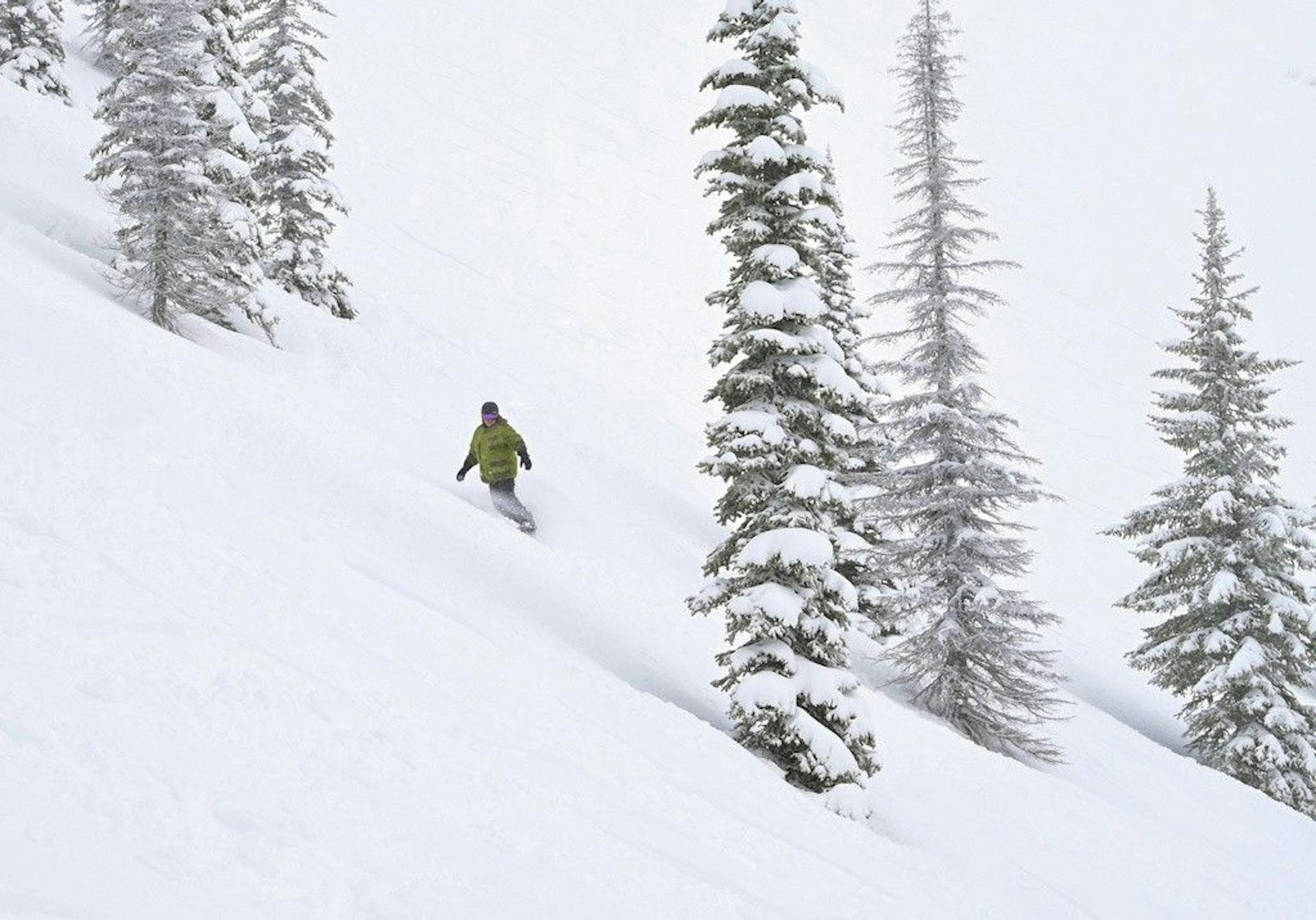
New Zealand finally has lifts spinning after a grim June. The Remarkables' July 1 report lists the mountain open with 5 of 7 lifts, 2 of 2 beginner areas, 10cm in the last 72 hours, and a 20-70cm base on main groomed trails. That is a real operating map compared with the 0cm reports that made mid-June feel like the calendar was lying.
But the same report keeps the interesting stuff in check: advanced terrain closed, expert terrain closed, extreme terrain closed, and Sugar Bowl, Curvey Basin, and Shadow Basin access still shut. The mountain is open. The mountain is not fully available.
Meanwhile, Australia is coming out of the opposite kind of week. Mountainwatch's July 1 Australian forecast says resorts took 40-60+mm of rain and 100-120km/h wind gusts on Tuesday, with more rain and wind Wednesday before the colder side of the storm arrives. That is not a soft launch. That is a beating.
So July starts with a clean split:
New Zealand has momentum and a storm risk.
Australia has storm damage and a snow chance.
5/7
Remarkables lifts
20-70cm
Remarkables base
40-60mm
Australia rain hit
20-40cm
Aussie upper-slope forecast
New Zealand Is Open. Now It Has to Hold.
The first July checkpoint is simple: New Zealand is no longer theoretical.
That matters because the last three weeks were mostly about delayed openings, small snowmaking windows, and public reports that read like careful apology notes. Cardrona got the South Island moving last Friday. The Remarkables and Mt Hutt joined the weekend push. Coronet Peak kept proving that snowmaking can carry a narrow early-season product when the sky does not cooperate.
Now the test changes.
Opening is not the question anymore. Expansion is.
Mountainwatch's July 1 New Zealand forecast gives the South Island two fine, settled days Wednesday and Thursday, which is exactly what ski fields need after last week's cold reset. Those are not wasted days. They are operations days: groom, patch, farm snow, make snow overnight where temperatures allow, assess thin spots, and decide what can be opened without turning the mountain into a rock-scrape festival.
Then the weather turns.
Friday brings strengthening northwest winds and showers into the Southern Lakes. Saturday starts ugly: heavy rain and strong northerlies before a cold front turns the precipitation to snow. By early Sunday, Mountainwatch expects the Southern Lakes to get a 5-10cm shot of quality powder, while Canterbury starts building into more meaningful snowfall later Sunday and Monday.
That is a weird forecast to sell.
It is also exactly the kind of forecast that separates a real early-season base from a cosmetic one.
If the warm phase chews into the thin cover too much, New Zealand's new operating map gets knocked back. If the cold side arrives cleanly and Canterbury cashes in, the slow start becomes a platform instead of a warning.
That is the week.
Not "winter is here."
"Can winter survive the first stress test?"
The Remarkables Is the Best Dashboard
The Remarkables is still the cleanest public scoreboard because its report shows both the good news and the caveat.
The good news: open mountain, open road, no chains required at the time of the July 1 update, 5 of 7 lifts open, both beginner areas open, and a groomed-trail base of 20-70cm. That is not a fake opening anymore.
The caveat: most of the terrain that makes The Remarkables feel like The Remarkables is not part of the product yet.
The official terrain breakdown lists novice terrain at 10% open, intermediate closed, advanced closed, expert closed, and extreme closed. Alta Blue is closed. The terrain parks are closed. Emerald Buttress, Wye Not Gate, Lookout, The Chutes, Upper Highway, Lower Highway, Homeward/Outward, and Shadow Basin access are all closed.
That sounds contradictory only if you think "open" means one thing.
It does not.
At this point, The Remarkables is open enough for beginners, early-season groomer laps, locals who know what they are signing up for, and skiers who are happy to treat July 1 like a warm-up. It is not open enough for someone booking a serious Queenstown ski trip and expecting the full alpine personality of the mountain.
That is not a criticism. It is the truth in the report.
And honestly, it is the right way to operate after a delayed start. Open what is defensible. Keep the consequential terrain closed until patrol, coverage, and the snowpack agree.
The report is not hiding the ball. Skiers just have to read past the headline.
Cardrona and Treble Cone Are the Wanaka Split
Cardrona is the progress story. Treble Cone is the patience story.
That split matters because travelers love to compress both mountains into "Wanaka skiing," but early winter does not work that way. The two resorts have different aspects, terrain profiles, snowmaking realities, and base-building problems. One can be useful while the other is still waiting.
Cardrona's first job was to stop the slide from delayed opening to non-story. It did that by getting a limited product moving last week. The next job is harder: build from learner-area and early-season terrain into something that can absorb school holidays, lessons, parks, and destination guests without every update needing fine print.
Treble Cone's job is even more blunt: get enough coverage to open in a way that makes sense.
This weekend's storm could help both, but it is not a clean gift. Mountainwatch has rain arriving first for the Southern Lakes Friday night into Saturday morning, then snow as the cold front arrives. For a thin early-season base, the order matters. Rain first can erase a lot of good work before snow gets a chance to improve the story.
So the useful Wanaka question is not whether the region gets weather.
It will.
The useful question is whether the colder half of the system pays back what the warmer half spends.
Mt Hutt May Get the Better Ending
Canterbury is where the upside looks more interesting.
Mountainwatch expects the heavy northwest phase to make Saturday difficult, possibly difficult enough that Canterbury ski fields are lucky to have much open. That is the ugly part. But after the cold front passes, snow starts falling at higher elevations, and Sunday afternoon into Monday is where Canterbury could build into the better side of the storm.
That makes Mt Hutt the mountain to watch.
The Southern Lakes may get the more photogenic early Sunday refresh. Mt Hutt may get the more important base-building sequence if cold southerlies keep feeding snow after the front clears. That is the difference between a social-media reset and an operations reset.
Mt Hutt matters because it usually gives the South Island season a spine. When it is rolling, the New Zealand season feels less fragile. When it is delayed or weather-hit, the whole country feels like it is waiting for winter to finish booting up.
This week is not about one good overnight total.
It is about whether Mt Hutt can come out of the first July storm with enough base, enough confidence, and enough open terrain to stop being part of the delayed-start narrative.
If Canterbury wins the cold side, New Zealand's early July looks a lot healthier by Monday.
Australia Took the Punch First
Australia is the warning label for everything above.
Perisher's July 1 report lists Perisher Valley and Smiggin Holes open, 5 expected lifts, 2 groomed runs, roads open, and a forecast of rain at times with strong northwest winds. That is operational, but narrow.
Thredbo's forecast has the same uncomfortable shape: rain or snow and damaging winds Thursday, then a much better snow chance Friday, especially around 1400m, with colder temperatures finally arriving.
Mountainwatch is more blunt. The Australian Alps have already taken 40-60+mm of rain and 100-120km/h wind gusts, with June going down as one of the worst snowfall starts and one of the warmest Junes on record. That is the kind of line ski marketers hate and skiers need.
The good news is that the storm is not done.
Mountainwatch still expects the colder phase to deliver 10-20cm on lower slopes and roughly 20-40cm on upper slopes by the main Friday snowfall event. If that lands cleanly, Australia finally gets a real rebuilding window after the rain damage.
But this is where early-season math gets mean.
Twenty centimeters after heavy rain is not the same as twenty centimeters on a preserved base. Some of the new snow is repair. Some is optics. Some is actually skiable improvement. The ratio depends on elevation, wind, grooming, snowmaking, and how much survived the warm phase.
Australia needs snow.
It also needs the storm to stop punching the product before it starts helping it.
The Word "Open" Is Too Small
This is the recurring problem with Southern Hemisphere coverage right now.
The word "open" is technically useful and practically vague.
Open can mean:
- 5 of 7 lifts and beginner terrain
- two groomed runs
- a learner carpet
- sightseeing plus snow play
- a road is open but terrain is limited
- a resort is operating, but the terrain you actually care about is closed
Those are all real products. They are not the same trip.
That is why July coverage has to move beyond opening dates. Opening dates are intent. Lift counts are capacity. Terrain mix is value. Base depth is resilience. Weather is risk. Road status is access. Put those together and you get the actual product.
Right now, the actual product is uneven.
New Zealand is healthier than it was a week ago, but still in a proof phase. Australia is worse than it looked before the rain, but has a legitimate snow window coming. Both can be true.
SnowRadar Take
The Southern Hemisphere ski season finally has enough going on to be interesting.
That is better than June.
But it is not time for lazy optimism.
New Zealand made the important jump from delayed openings to operating lifts. The Remarkables has a real, measurable footprint now. Cardrona has momentum. Mt Hutt may have the best upside if Canterbury gets the colder back half of the storm. That is the good version of the story.
The harder version is that the base is still young, the terrain mix is narrow, and the next system starts warm and windy before it becomes useful.
Australia is the harsher example. Perisher and Thredbo are open, but the rain and wind damage was real, and the next snow has to rebuild before it can expand.
So the practical read is this:
If you are local, watch the daily reports and go when the product fits your expectations.
If you are booking travel, ignore the binary open/closed language and read the lift count, terrain status, base, and next 72 hours of weather.
If you are tracking the season, the next useful headline is not who opened.
It is who holds.
Tracking the Southern Hemisphere start? Keep Southern Hemisphere Ski Watch, Ski This Week, and the SnowRadar forecast open. The calendar says July. The snowpack still gets a vote.