Week Ahead: The Storm Is Here. So Are the Wind Holds.
Australia finally has a proper July storm cycle, New Zealand is building depth, and the honest scoreboard this week is not snowfall. It is what can actually run.
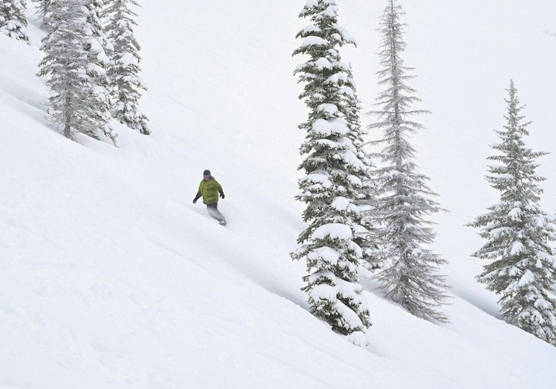
The Southern Hemisphere ski season finally got the thing it was begging for.
Snow.
Now comes the less romantic part.
Wind holds. Wet lower slopes. Chains. Lift line math. School-holiday pressure. Terrain that looks close on a webcam but still needs grooming, patrol work, and enough cold air to survive traffic.
That is the week ahead.
Perisher's July 13 report says the current storm has dropped 25cm so far, including 10cm since yesterday, pushing natural depth to 53.4cm. The resort expected 21 lifts and 21 groomed runs, with Perisher Valley, Smiggin Holes, and Blue Cow listed as open areas. That is the best operational number Australia has had in weeks.
It also came with the line that matters most: high winds may impact lift operations.
Mountainwatch's Monday forecast has the same shape. Australia picked up 10-20cm+ by Sunday morning, with another 10-30cm possible through Tuesday night on mid and upper slopes, but snow levels mostly between 1600m and 1800m and strong west-to-northwest winds capable of hitting lift operations.
In other words:
The storm is real.
So is the fine print.
25cm
Perisher storm total so far
53.4cm
Perisher natural depth
10-30cm
More Australia snow possible
6/7
Remarkables lifts open
Australia Finally Has Something to Work With
This is the best Australian ski headline in a month:
The second storm is not theoretical anymore.
Perisher has moved from early-July rescue mode into something closer to a ski product. The July 13 report says Summit Quad opened for the first time this season over the weekend, along with Hume T-Bar at Smiggins. That matters because this season has not been short on marketing language. It has been short on spread-out terrain.
The mountain now has more of both.
But the week is not a victory lap.
The storm is arriving with exactly the kind of weather that makes resort ops miserable. Perisher's own report flagged blizzard-like conditions, scattered snow showers, and strong winds. Mountainwatch expects snow to keep falling mostly on mid and upper slopes Monday and Tuesday, while lower slopes deal with wetter conditions and winds keep pushing into operational territory.
That is not a complaint.
That is how storm cycles work.
The useful thing for skiers is to stop treating "snowstorm" as a synonym for "easy ski day." Sometimes the best day of a storm is two days later, after patrol work, grooming, snowmaking, and lift maintenance get a calmer weather window.
Mountainwatch points to Wednesday through Friday as the cleanup window: clearing weather, easing winds, then sunny and warmer days into the end of the week. That may be when this storm becomes most useful for normal humans.
Powder people can chase today.
Families may want the post-storm product.
Perisher Has the Best Australian Case
Perisher now has the cleanest Australian story because the numbers finally stack.
10cm in 24 hours. 25cm in seven days. 53.4cm natural depth. 21 expected lifts. 21 groomed runs.
That is not a huge midwinter base, but it is no longer the grim June/early-July question of whether there is enough white stuff to pretend. It is a platform. It is also a platform arriving during school holidays, which means it will be tested immediately.
The important shift is that Perisher can now talk about expansion instead of survival. Summit Quad opening for the first time this season is not just another lift-status bullet. It spreads people out. It changes the feel of the day. It turns the mountain from a compressed beginner/intermediate funnel into something closer to a real resort.
Still, the report's wind caveat should be taken seriously.
A mountain can have 21 expected lifts at breakfast and a very different operating shape at 10 a.m. if the wind starts winning. That is not a failure. It is why checking the live lift report matters more than reading yesterday's storm total.
This week, Perisher's best-case arc is obvious:
Get through the windy snow days, use the cold windows, keep adding lifts and groomed runs, then let the calmer midweek weather turn the storm into confidence.
That last word is still the hard part.
Australia did not just lose snow in June.
It lost trust.
Thredbo Is Trying to Turn Fine Print Into Momentum
Thredbo is in a similar but slightly different phase.
The resort's site is leaning into school-holiday energy, events, and the return of proper skiing, with the July Kids Snow Festival running through July 19 and Environment Week starting July 13. The social/news feed has also moved from careful limited-product language toward the thing skiers wanted to hear: Upper Supertrail is open top-to-bottom.
That is a big psychological shift.
Last week, Thredbo's key detail was that Upper Supertrail access still required downloading from Bunny Walk Mid Station to get back to the village. That is the kind of fine print that separates "open" from "open in the way people imagine."
Now the mountain has a better story.
But the same storm caveats apply. Mountainwatch's snow report page had Thredbo under a wind-hold update Monday morning, with Kosciuszko, Cruiser, and the gondola currently on wind hold while Snowgums, Gunbarrel, and Easy Does It were open. The seven-day snow forecast table on Mountainwatch had Thredbo among the leaders, with 34cm possible over the next week.
That is promising.
It is also exactly why the next few days are not just about snowfall.
If the storm arrives mostly as upper-mountain snow and lower-mountain wetness, the question is how quickly Thredbo can protect the top-to-bottom story. Supertrail matters because it is iconic, legible, and easy for casual guests to understand. Lose the lower pieces and the product gets complicated again.
Thredbo does not need a miracle week.
It needs continuity.
New Zealand Is Ahead, But Still Weirdly Young
New Zealand looks better than Australia right now, but the season is still younger than the calendar says.
The Remarkables' July 13 report is the cleanest snapshot. The mountain is open, with 8cm in the last 24 hours, a 15-60cm groomed-trail base, 53cm of season snowfall, 6 of 7 lifts open, and both beginner areas operating.
That is a real product.
It is also not a fully mature one. The Remarkables still says to stay on trail off-piste. Its detailed terrain mix showed novice terrain fully open, intermediate terrain at 60%, advanced terrain at 5%, and expert/extreme terrain closed. Shadow Basin was closed in the lift list, while Alta, Sugar Bowl, Curvey Basin, and the conveyors were running.
That is not bad news.
It is useful news.
The Remarkables is a perfect example of why lift count alone can flatter a young season. Six of seven open sounds nearly done. The terrain breakdown says the mountain is still very much in staged expansion mode.
That is where the honest ski trip decision lives.
If you want groomers, beginner terrain, and a clean early-season resort day, The Remarkables has a strong case. If you are picturing deep off-piste and big advanced terrain, the mountain is telling you to wait.
Listen to the mountain.
Canterbury Got Buried. Now It Has to Hold
The most interesting New Zealand note is Canterbury.
Mountainwatch says last week's storm delivered snow "in the nick of time" to Kiwi resorts, with Canterbury getting 70-120cm of powder. That is the kind of number that can change a season's direction fast.
But this week's forecast is not a simple victory parade.
Mountainwatch expects a rough start to the work week in New Zealand, with fronts crossing Monday and Tuesday, strong northwesterlies, and a mix of rain and high-level snow. The Southern Lakes could get 5-30cm on upper slopes Monday, with Treble Cone likely favored by proximity to the Main Divide. Canterbury, after the big dump, may see more wind and rain issues before another colder shot brings upper-slope snow Wednesday.
That is the theme again:
Snowfall is not the same as skiability.
Canterbury may have the best base-building upside in New Zealand right now, but young snowpacks hate rain and wind. A huge storm can create the foundation. The next weather pattern decides how usable that foundation becomes.
Mt Hutt is the place to watch.
If Canterbury holds the new snow and gets a colder follow-up, it can become the anchor of the New Zealand season. If the northwesterlies chew into the lower mountain and complicate operations, the story stays messy.
Either way, the season finally has material.
That alone is a major improvement from late June.
Cardrona and Treble Cone Have the Cleanest Psychological Win
Cardrona and Treble Cone may have the most important simple sentence in Southern Hemisphere skiing right now:
Both are open.
The Cardrona-Treble Cone snow report lists both mountains open. That sounds basic. It is not.
Two weeks ago, the Wanaka story was still lopsided. Cardrona was carrying the regional product while Treble Cone waited for a natural base that made sense. That was the responsible call, but it also kept the destination pitch awkward. A Cardrona-only trip is workable. A Cardrona-plus-Treble-Cone trip feels like a ski holiday.
This is where the psychology matters.
Australia is still trying to rebuild traveler confidence after a brutal start. New Zealand is starting to look like it can offer choice again. The difference between one usable mountain and two usable mountains is not just terrain acreage. It is booking confidence, itinerary flexibility, and the feeling that a destination has options if the weather picks a fight with one aspect.
Treble Cone will still need careful reading. It is not a snowmaking-heavy beginner factory. It needs natural snow, and its best terrain should not be rushed. But "open" is a meaningful threshold because it changes the Southern Lakes pitch from survival to selection.
That is progress.
What to Watch This Week
The lazy version is to watch snow totals.
The useful version is to watch conversion.
In Australia, watch Perisher's live lift report. The mountain now has the strongest base-depth and lift-count argument, but wind is the limiter. If the expected-lift number turns into actual reliable operations by Wednesday and Thursday, this storm cycle worked.
Watch Thredbo's lower-mountain continuity. Top-to-bottom Supertrail is a much bigger story than another isolated upper-mountain lap. If the lower connection survives the wet/windy part of the storm and snowmaking gets a cold enough window, Thredbo's school-holiday product gets much easier to trust.
Watch Hotham, Falls Creek, Buller, and the smaller Victorian fields for the same pattern: did the snow turn into lifts, or did warmth and wind keep the story in the report instead of on the hill?
In New Zealand, watch The Remarkables' advanced terrain percentage, not just its lift count. Six of seven lifts open is good. Five percent advanced terrain is the honest warning label.
Watch Cardrona and Treble Cone because the shared open status changes the Wanaka trip math. Watch Mt Hutt because Canterbury's huge storm total gives it the biggest upside if the next few days do not damage the base too much.
And watch road reports everywhere.
Chains are not trivia. Wind holds are not footnotes. Wet lower slopes are not a vibes issue. These are the things that decide whether a storm becomes a ski week.
SnowRadar Take
This is the best Southern Hemisphere week of the season so far.
It is also exactly the kind of week that exposes sloppy snow coverage.
Australia finally has a real storm cycle. Perisher has a legitimate operating story. Thredbo has a cleaner top-to-bottom pitch. New Zealand has multiple regions moving from delayed openings into actual terrain management.
But none of this is finished just because it snowed.
The next few days are an operations test:
Can lifts run?
Can lower slopes hold?
Can resorts spread out school-holiday crowds?
Can New Zealand's new snow survive the wind and rain phases?
Can travelers start trusting the calendar again?
That is the week ahead.
Use SnowRadar's forecast tools, check the Southern Hemisphere Ski Watch, and read official reports like a grown-up.
The storm finally arrived.
Now the resorts have to turn it into skiing.